Trek South
-
Overview
Overview
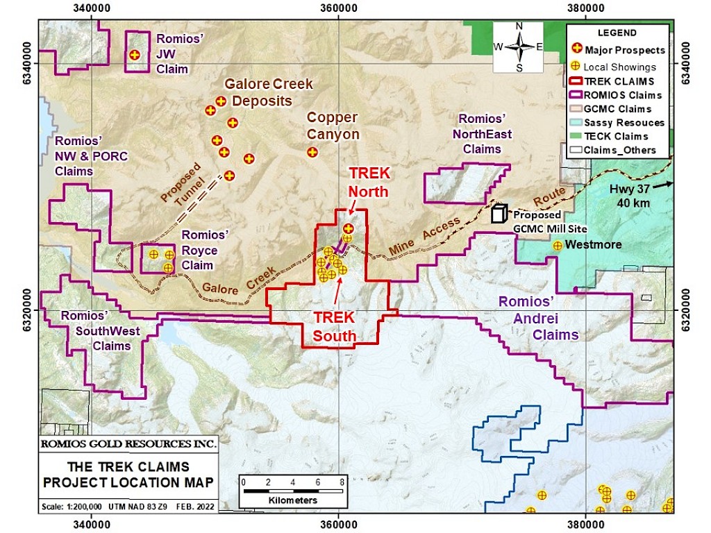
Property Type- The Trek South claims make up the southern 2/3 of the Trek property on the north-facing slope south of Sphaler Creek.
- These claims cover the recently discovered Trek South copper-gold-silver porphyry system and an associated area of widespread copper-tungsten skarn mineralization discovered in 2022.
- Numerous historic showings occur immediately north and west of the porphyry system including the high-grade Toe Zone Cu-Au-Ag-Zn-Pb-Sb VMS prospect and the Tangle Zone porphyry prospect (see Trek Project page).
Size- 4,649 Ha with a primary focus on a 660 Ha area 3 km x 2.2 km.
Status- All claims are wholly owned by McLymont Mines Inc., a subsidiary of Romios Gold Resources Inc.
Exploration Stage
- The Trek South porphyry-skarn prospect is now at the drill-ready stage.
- Geological mapping, rock sampling, hyperspectral surveys, 3 lines of IP surveying and one line of MT surveying were completed in the 2019-2022 period. An airborne magnetic-EM survey was completed in 2007 and this data has proven very useful in light of the recent work.
- Several strong drill targets of considerable extent are evident in the 2022 IP results (up to >800 m long x 250-500 m wide and >600 m deep). These geophysical targets underly the centre of the porphyry system and extend under the Cu-W skarn area.
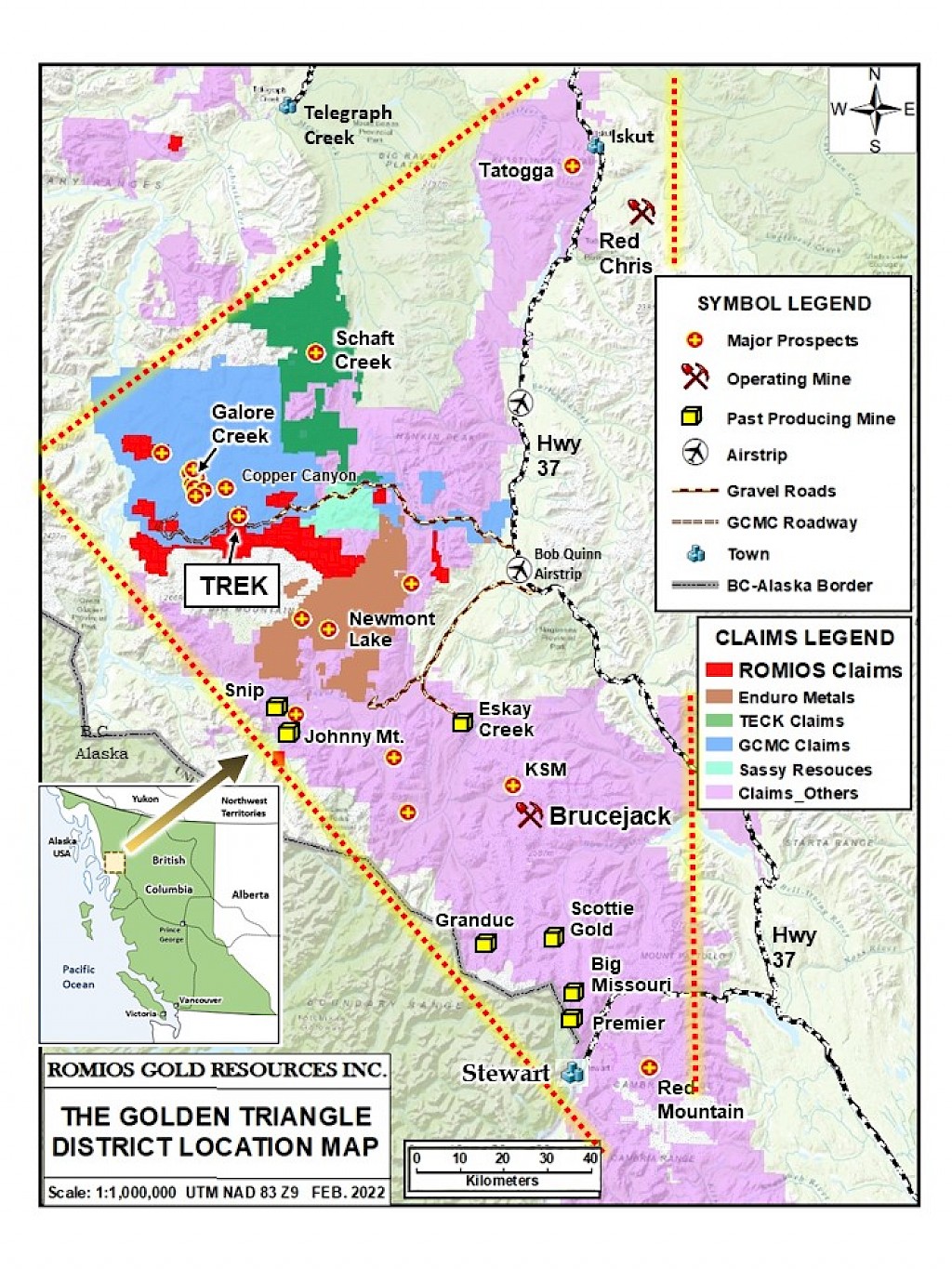
Location
- In the centre of BC’s Golden Triangle, 12 km SE of the giant Galore Creek porphyry Cu-Au project and 12 km SW of the proposed Galore Creek mill site.
- 58 km west of Provincial Highway 37 and BC Hydro’s adjacent high-voltage power line.
- The partially cleared road route from Highway 37 to the proposed GCMC mill site and onward to the Galore Creek deposits crosses the centre of the Trek claims, 1.3 km north of the Trek South porphyry and skarn prospects.
- The Galore Creek project is operated by Galore Creek Mining Corportion (GCMC), a Joint Venture between Teck Resources Ltd. and Newmont Corp. A pre-feasibility study on the project is currently underway and nearing completion (as of late 2022).

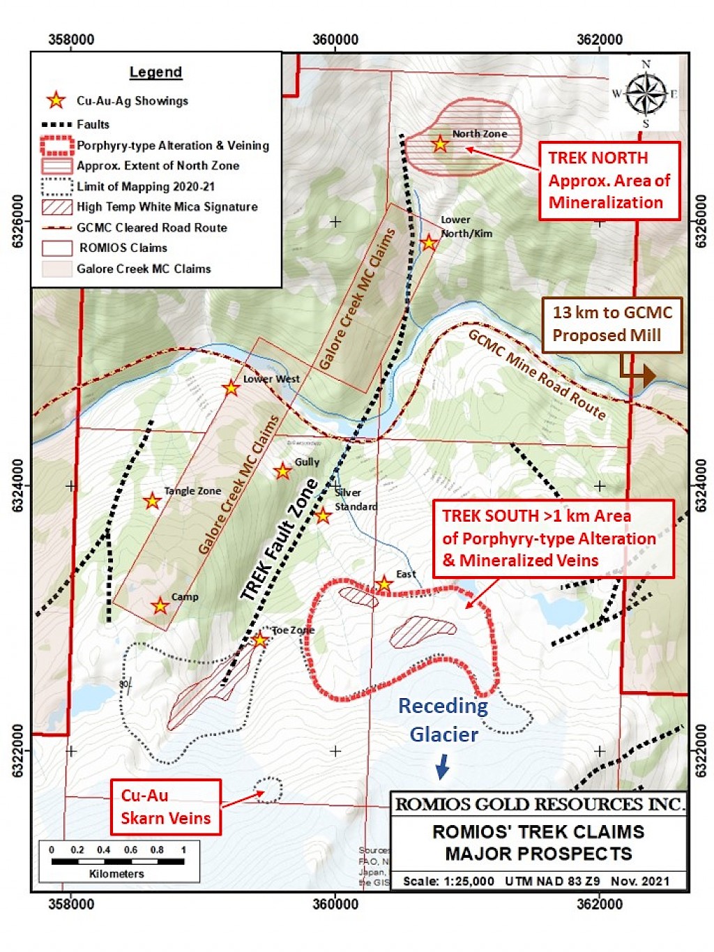
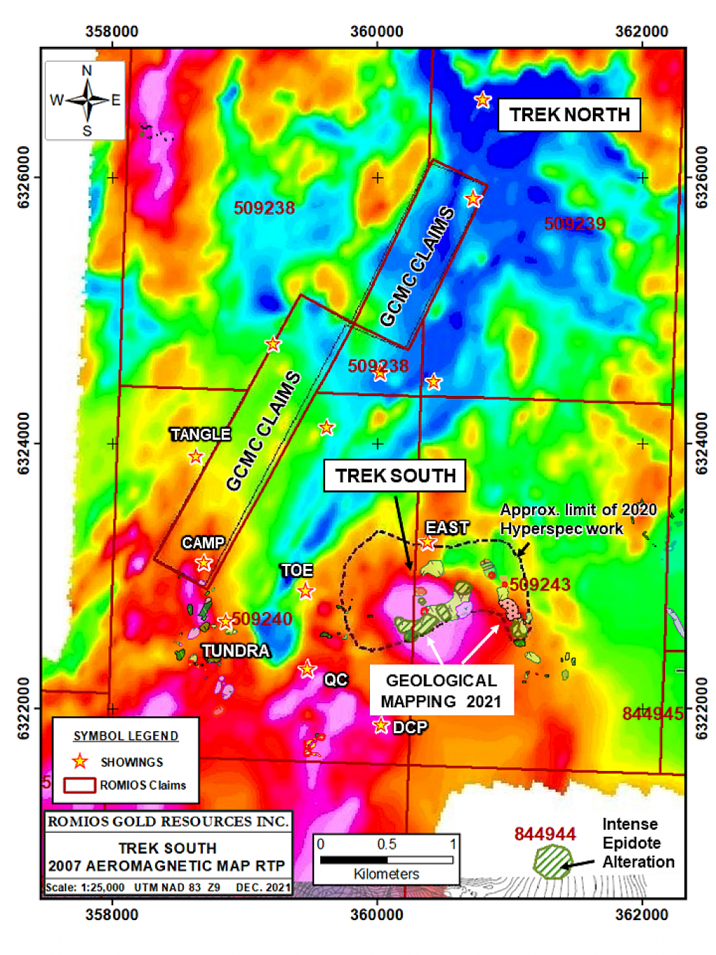
Map 1: Compilation map of Trek South geology, IP anomalies, porphyry system extent and skarn zones
-
Geology/Exploration
Highlights of Key Target Areas
GEOLOGY
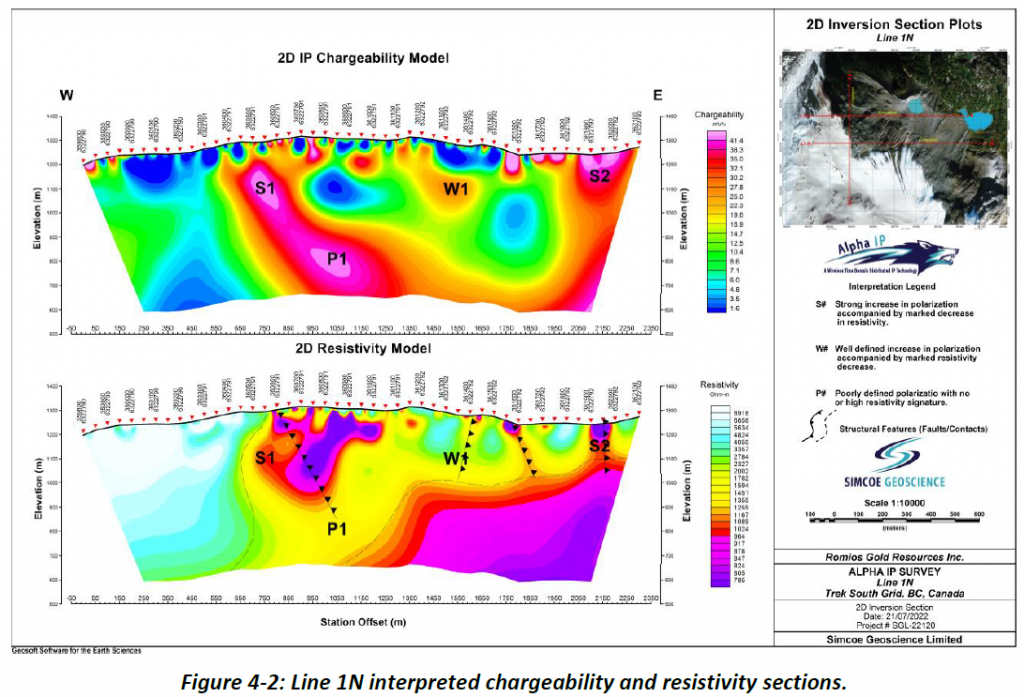
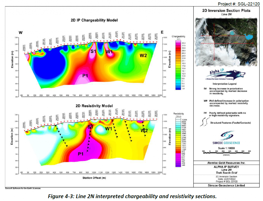
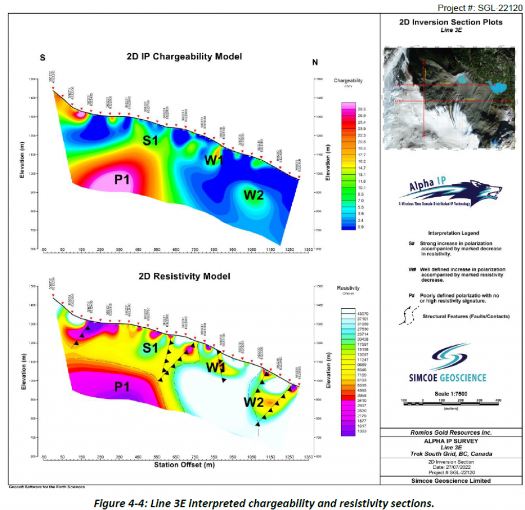
The 2022 exploration program at Trek South identified a major IP chargeability high underlying the centre of the porphyry Cu-Au-Ag system discovered in 2021 and hosted largely by mafic volcanics and lesser metasediments. The IP anomaly extends from the centre of the exposed porphyry system to the NE beneath an extensive, newly discovered area of locally Cu-W mineralized skarn. The IP anomaly is interpreted as being >800 m long (NE-SW), 250 to 500 m wide, and extending to a depth >600 m. An MT (Magnetotelluric) survey conducted over one of the IP lines suggests that the IP anomaly extends to a depth of about 2 km. Three additional IP anomalies flank this main target and remain to be investigated in the field. Although the 2022 surveys were the first ground geophysical surveys ever conducted on this Trek South target, the size and strength of the anomaly, and its location under a known porphyry Cu-Au system and an adjacent area of skarn mineralization, makes this feature a high-priority drill target. Details of the porphyry system, skarn zone and geophysical results are presented below. The relevant maps and figures for these topics are included in the MAPS/FIGURES section.
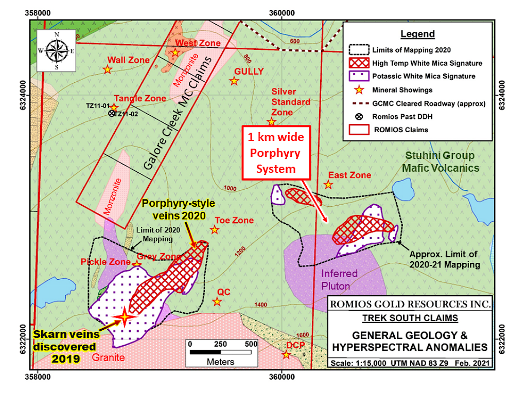
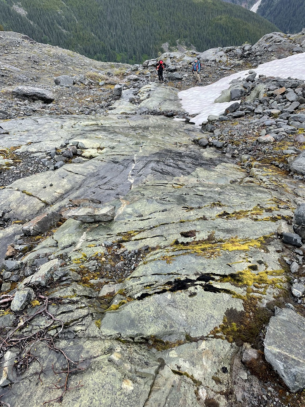
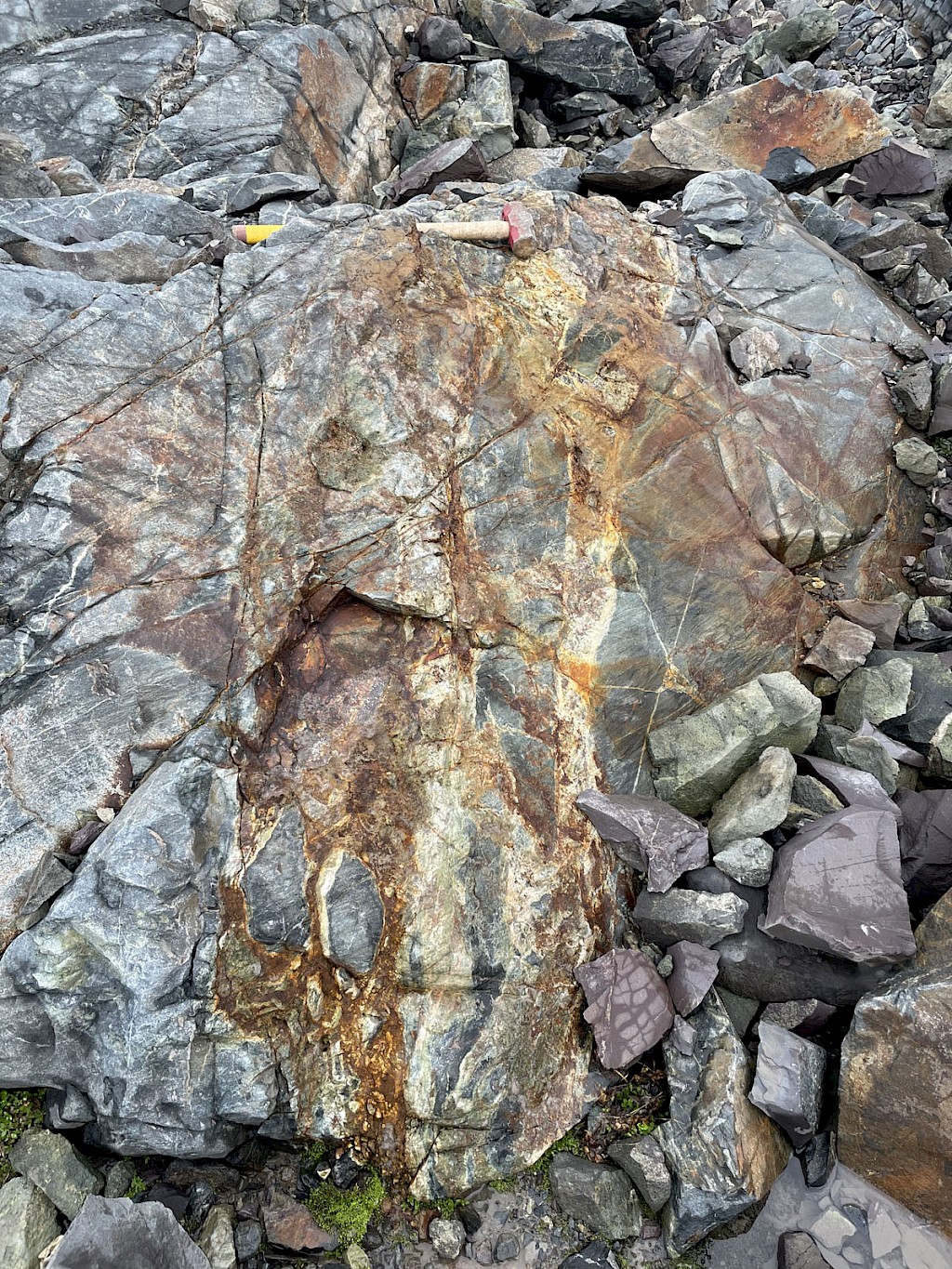
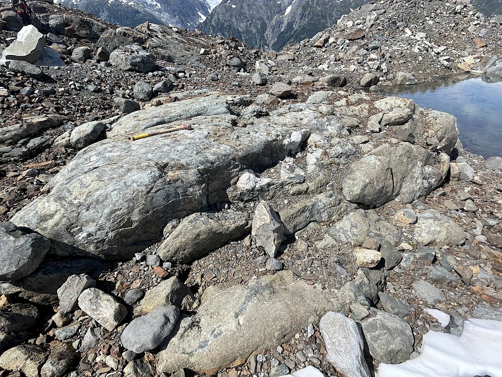
THE TREK SOUTH PORPHYRY CU-AU-AG PROSPECT was discovered in 2021 after a local glacier and icefield receded far enough to expose a ~1 km wide zone of strong epidote (propylitic) alteration within the local volcanic and metasedimentary rocks, overprinted by a stockwork of quartz-pyrite veins with local Cu, Au and Ag mineralization. The southern margin of the mapped porphyry system lies along the northern edge (toe) of this 800 m wide glacier and it is believed to extend well under the ice. A 3D inversion model of the 2007 aeromagnetic data has outlined a probable granitic pluton ~800 m wide, beginning at shallow depths beneath the exposed porphyry system and continuing southward under the edge of the glacier.
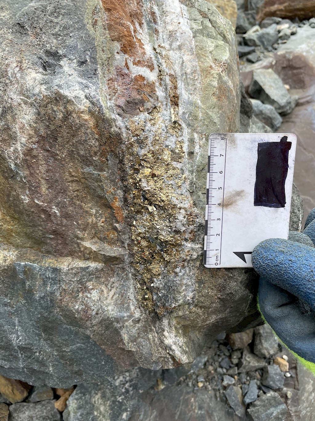
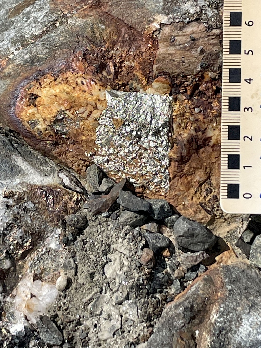
The quartz-pyrite veins are exposed over an area about 800 m E-W and >300 m N-S. The veins are typically 1 to 10 cm wide, locally form dense stockworks, and numerous samples have returned significant individual assays up to 1.93% Cu, 2.3 g/t Au and 257 g/t Ag. A cluster of boulders from the recently exposed area in front (north) of the glacier that flanks the southern exposed margin of the porphyry system contains numerous thin veinlets and fracture coatings of bornite and chalcopyrite. A composite grab sample of these veinlets assayed 2.86% Cu, 8.85 g/t Au and 46.5 g/t Ag, indicating that there is likely high-grade mineralization still hidden beneath the nearby glacier. Two mineralized boulders from the western margin of this same glacier assayed 2.91% Cu and 3.46% Cu.
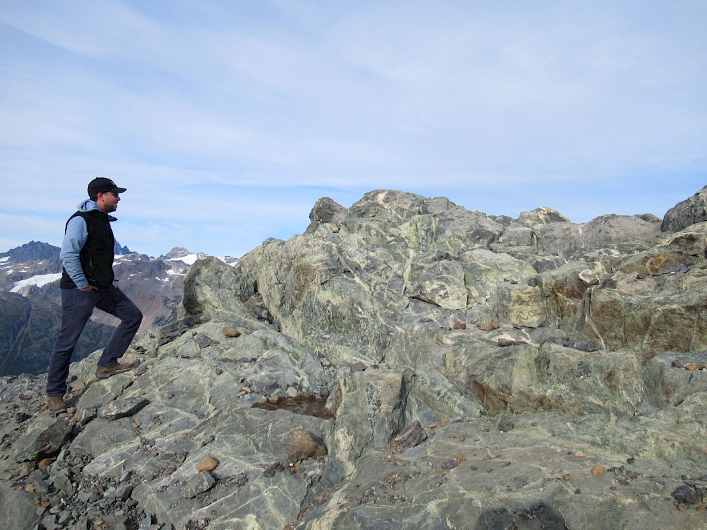
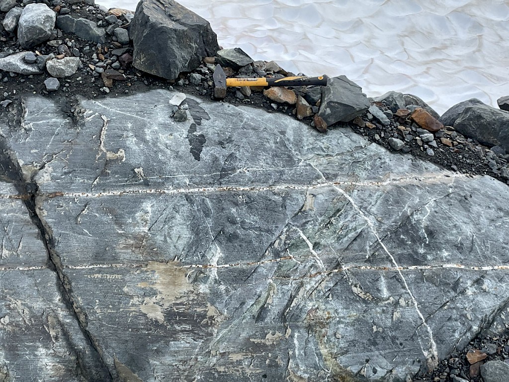
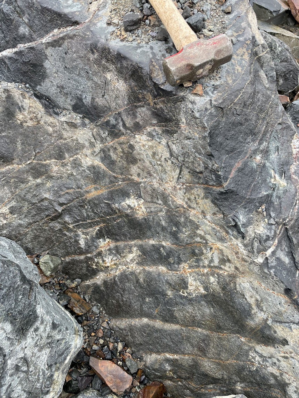
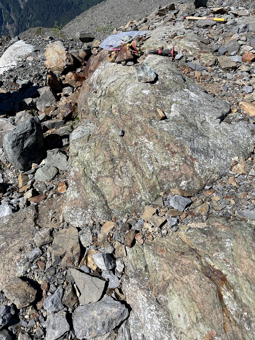
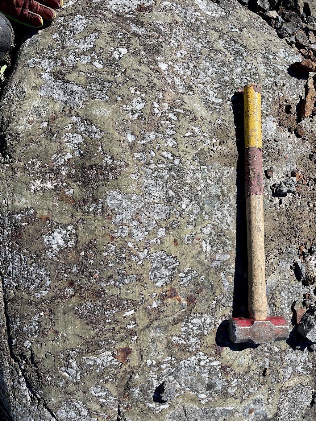
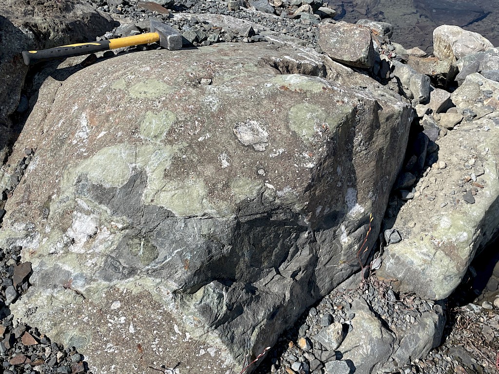
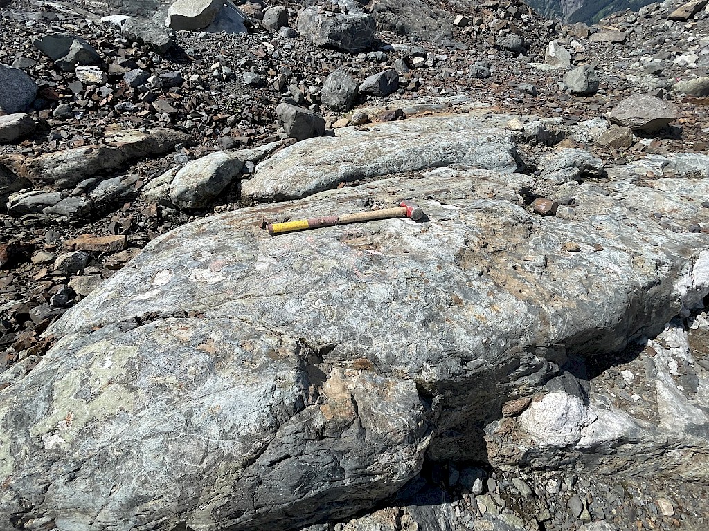
The ~1 km wide epidote alteration zone consists of a well-developed stockwork of veins ~1 cm to 1 m wide, as well as pervasive alteration of fragments and/or the matrix of volcanic breccias, and several impressive zones up to 40 m wide and >50 m long of almost complete epidote alteration. The epidote veins/alteration zones locally contain visible copper mineralization (chalcopyrite, bornite, malachite) and have returned assays up to 2.2% Cu, 1.28 g/t Au and 74 g/t Ag. A large area of intense epidote alteration with minor copper staining was also located on a ridge top 1.4 km SE of the main Trek South porphyry exposures in the fall of 2022, once the local snow fields had melted. This area requires a through mapping and sampling program but appears to indicate that the porphyry alteration system is much bigger than the 1 km exposed area described above.
A number of other, normally less common, metals locally occur at highly anomalous levels in some of the quartz-pyrite veins in the approximate centre of the exposed mineralized area and support the porphyry Cu-Au-Ag model for this site: arsenic up to 486 ppm, bismuth up to 863 ppm, tellurium up to 317 ppm, and vanadium up to 870 ppm. Pyrite accumulations in vuggy cavities within several pegmatite dykes also contain significant metal contents – 0.25% Cu, 386 ppm Co, 11.5 g/t Ag, 121 ppb Au, 551 ppm Mo, and 364 ppm WO3 – and add further evidence that the Trek South mineralization is derived from an underlying granitic intrusion.
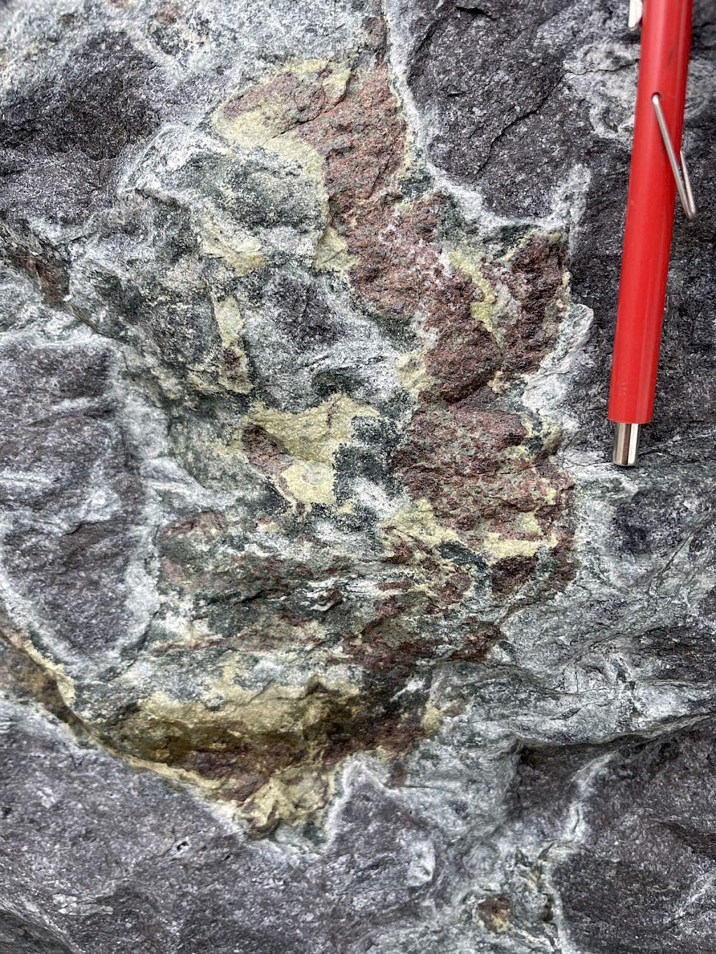
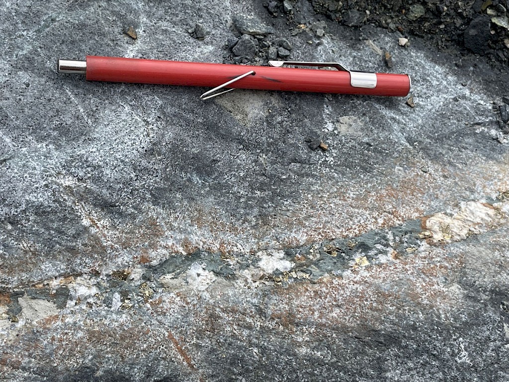
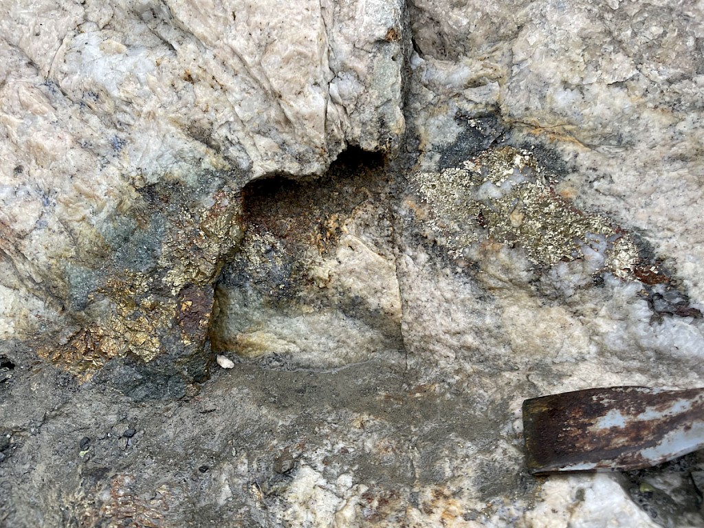
THE TREK SOUTH COPPER-TUNGSTEN SKARN was outlined by Romios’ geologists in the summer of 2022 after an initial find of a single skarn outcrop in 2021. Well developed, massive to banded skarns consist of red garnets and green epidote (+/- pyroxene?), lesser calcite, several per cent disseminated pyrite, and minor local chalcopyrite, malachite and magnetite. It occurs in outcrops scattered throughout two roughly parallel skarnified belts exposed for 220 m X 85 m and 100 m x 25 m, separated by 30-60 m of volcanic rocks. Twenty-one samples (of the 28 samples collected here) returned WO3 values between 0.04% and 0.68% WO3, averaging 0.24% WO3. Samples include grabs and numerous chip samples across 10-30 cm widths as well as wider chip samples with appreciable tungsten grades, e.g. 2.0 m @ 0.16% WO3 and 0.5 m @ 0.4% WO3. It should be noted that the sampling program was focussed on gossanous, sulphidic areas of the skarn and the tungsten mineralization (off-white, fine-grained scheelite?) was not obvious in the field. The presence of tungsten mineralization was only revealed by the assay results and it may not be concentrated in the gossanous areas that were the focus of the sampling program. Future sampling programs will require the use of a UV light to help define the extent of the tungsten mineralization in the field for a thorough sampling program.
Copper and gold values are relatively consistent compared to the range of corresponding tungsten values. With one exception, the 18 samples with >500 ppm WO3 (i.e., one lb/t) average 0.227% Cu with a range of 0.07% to 0.45% Cu. In contrast to the elevated gold levels in the quartz-pyrite veins throughout the adjacent porphyry-type alteration/mineralization system, the gold values in these skarnified rocks are generally low, averaging just 0.033 g/t Au with a range of 0.002 to 0.21 g/t Au. Silver values average 4.4 g/t Ag with a range of to 0.95 to 9.8 g/t Ag. Three samples also contained elevated molybdenum values between 488 and 707 ppm Mo.
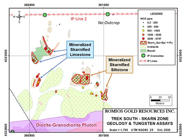
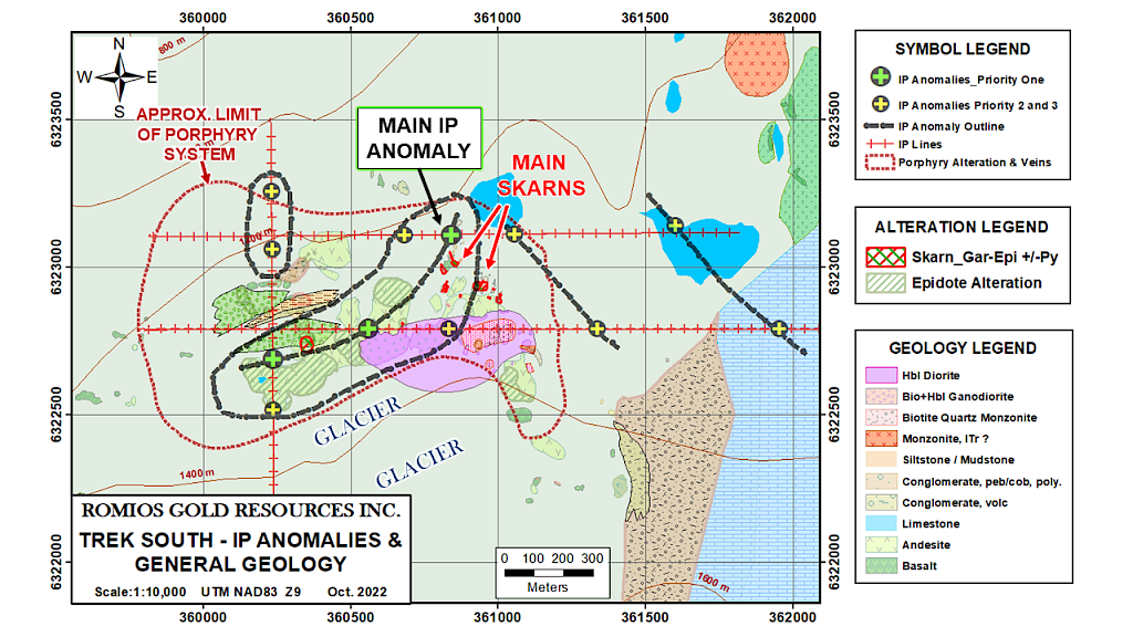
Map: Geology and 2022 sample map of the main skarn zones at Trek South, adjacent to IP anomalies on Line 2 The known skarn outcrops occur ~200-350 m horizontally NE of the estimated margin of the buried pluton beneath the adjacent porphyry system and likely 2-300 m vertically above the pluton. In skarn deposits elsewhere, mineralization is typically the most well developed adjacent to the source pluton margins. To have such widespread skarn development and such high-grade Cu-W local mineralization at these distances from the presumed source pluton at Trek South is considered very encouraging for the potential of this zone.
Individual horizons of the most well-developed skarns at Trek South are typically exposed for widths of ~3 m to 12 m and lengths of ≥50 m, with broader exposures up to 50 m x 20 m of moderate skarnification. These skarns formed by the alteration of limestone, calcareous siltstone, and local conglomerate units, none of which had been mapped in the past. Several feldspar-porphyritic felsic dykes 2.5 to 5 m wide were found at 2 of the most well-developed skarn sites and similar dykes occur in skarn boulders at the toe of the glacier. It is suspected that these dykes are derived from an underlying alkalic pluton and samples of this rock are now being age-dated and undergoing lithogeochemical analysis to determine if they are part of the productive Galore Creek suite.
The full extent of the skarnified metasediments remains unknown as their northern and eastern limits are obscured by glacial till. However, the 2007 airborne EM survey outlined a low resistivity area coincident with the host metasediments approximately 300-500 m wide and extending to the NNE about 500 m from the known outcrops. A good deal of this low resistivity feature is overlain by glacial till but some exposures are visible on satellite imagery and will be explored in 2023.
GEOPHYSICAL RESULTS: The results of the 2022 IP and MT surveys are considered very encouraging and they have generated drill targets of the highest priority.
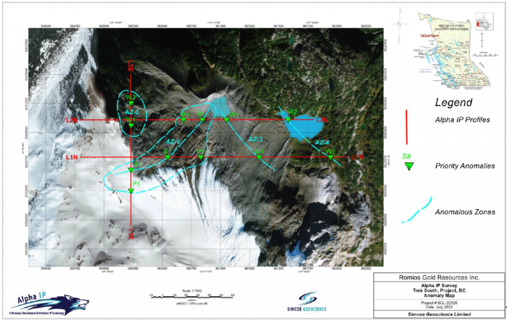
IP/MT Surveys: In July 2022, Simcoe Geoscience completed 3 lines of Alpha IPTM over the Trek South porphyry target and the newly discovered Cu-W skarn adjacent to it. The line lengths totalled 5.6 km with individual line lengths ranging from 1.3 km to 2.3 km, producing readings to maximum depths of ~400 m to ~650 m. Simcoe has now identified 12 chargeability anomalies, 3 of which are classed as Priority One and 9 are Priority Two or Three (see MAPS/FIGURES section). The 3 Priority One anomalies are aligned in a NE-SW trend and interpreted as a single, >800 m long body, 250 to 500 m wide and at least 600 m deep. This extensive anomaly is also considered quite strong, reaching >40 mV/v over a large proportion, indicating the presence of abundant sulphide mineralization. The MT survey completed over IP Line 1 is capable of “seeing” to much greater depths than IP and it detected a low resistivity feature coincident with the main IP anomaly and extending to a depth of about 2 km. This large IP/MT target is now the primary focus of Romios anticipated 2023 drilling. A >500 m long Priority Two anomaly trend ~175 m east of and parallel to the main skarn horizons is also of considerable interest as a potential drill target. The potential of the two remaining IP anomaly trends remains to be determined through further geological mapping.

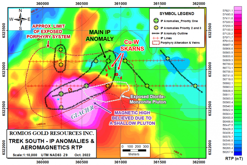
Map: Compilation map of IP anomalies, porphyry and skarn zones overlain on aeromagnetic map
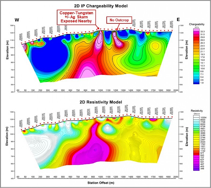
Figure 1: 3D Inversion Models of the IP Chargeability and Resistivity results, Line 2 3D Magnetic Susceptibility Model Of 2007 Aeromagnetic Survey: At Romios’ request, experts from Simcoe Geoscience recently completed a 3D inversion model of existing aeromagnetic survey data over the IP survey area. This aeromagnetic survey was undertaken in 2007 by Fugro Airborne Surveys Inc. on Romios’ behalf and the resultant maps clearly show a circular magnetic feature approximately 1.1 km x 0.8 km that underlies a large portion of the Trek South porphyry-style epidote alteration and quartz-pyrite stockwork area. Romios’ geologists have recently suspected that this magnetic high reflected a granitoid intrusion at depth responsible for the porphyry-style alteration and mineralization. The 3D model generated by Phoenix is consistent with a pluton ~800 m wide (E-W), starting ~2-300 m below surface and extending to a depth >1.5 km. The main, >800m long IP anomaly extends from the skarn horizons in the north to the southwest along the margin of this suspected pluton.
The combination of the modelled presence of a large pluton beginning at shallow depth under a 1 km wide porphyry Cu-Au-Ag system, an adjoining area of extensive mineralized skarn development, and such a substantial, strong IP anomaly, has provided a series of immediate drill targets of the highest priority.
Geological Setting and Ongoing Studies: Trek South is underlain mainly by late Triassic Stuhini Group mafic volcanics (andesites and basalts) and several recently discovered formations of limestone, calcareous siltstones, and conglomerates that are commonly skarnified over large areas. (Large portions of this area were covered by ice and snowfields until recent years and many of these key units were poorly exposed in the past). Romios’ mapping in 2021-22 has also revealed the presence of a previously unknown, zoned diorite-granodiorite-monzonite pluton (field names) at least 600 m x 250 m with minor ubiquitous disseminated pyrite throughout. The closest skarnified sedimentary formations are exposed 30 m north of this intrusion and strike towards it, however, it is currently believed that this is a younger intrusion unrelated to the skarn process. The major IP chargeability high coincident with the northern portion of the skarns continues SW past the western margin of this younger (?) pluton and alongside the geophysically inferred granitic pluton at depth which is thought to be the source of the mineralizing fluids.
In this part of the Golden Triangle, porphyry mineralization and the skarn mineralization frequently found with it are typically associated with a specific, narrow age-range of intrusions belonging to the alkalic Galore Creek suite, 210 to 200 Ma (million years old). A number of feldspar porphyry dykes were discovered within the skarns this year and these are suspected of belonging to the Galore Creek suite. Age-dating of one such dyke and the zoned diorite-granodiorite-monzonite pluton is currently underway at the University of British Columbia.
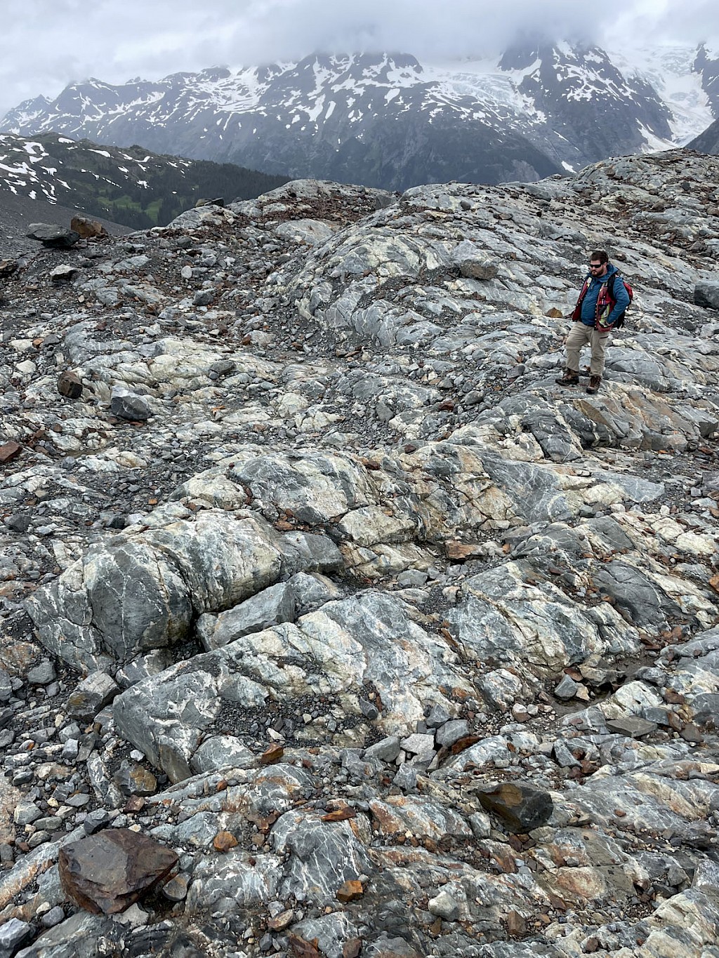
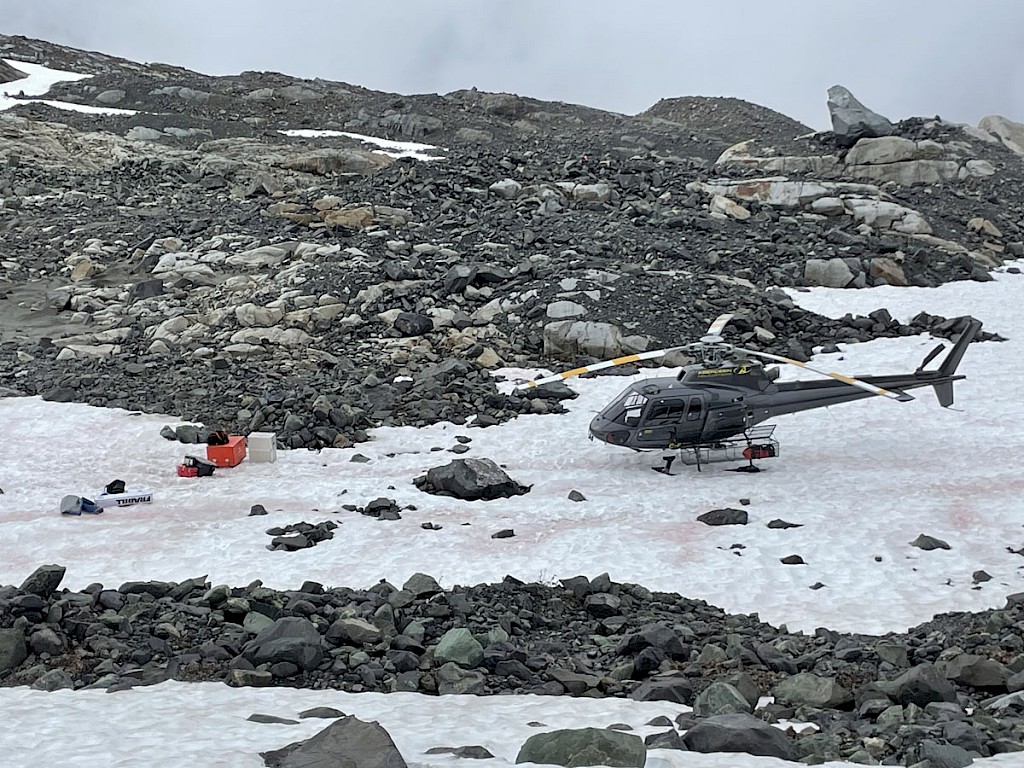
Favourable Topography
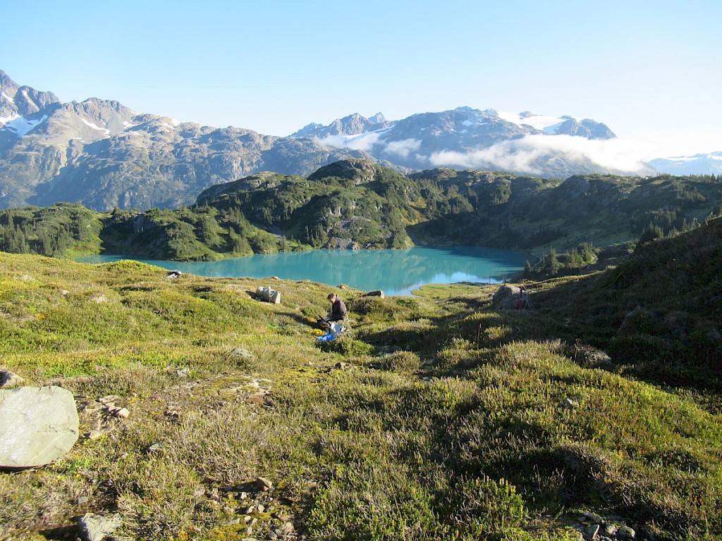
The Trek South area is one of the most topographically favourable on the Trek claims as overall it is not particularly rugged or steep for this part of the world and it is relatively easy to traverse. The area of the main prospects is, for the most part, a bare rocky slope with no trees or bushes. This slope descends northward into the floor of Sphaler Creek, the route of the partially constructed and cleared road route from Galore Creek to Highway 37.
Conclusions
The Trek South combined porphyry Cu-Au-Ag and adjacent Cu-W skarn is now Romios’ highest priority drill target in the Golden Triangle. The combination of a >1 Km wide porphyry system with locally high-grade Cu-W mineralization scattered over an area hundreds of metres across points to a significant mineralizing event, now believed to be centred over a granitic pluton that begins at shallow depths. The core of this system has been defined by a very successful IP-MT survey that has identified a strong (>40 mV/v) chargeability high and resistivity low of considerable size, >800 m long, 250-500 m wide, at least 600 m deep and perhaps as much as 2 km deep. Multiple drill targets are now evident along this anomaly and the overlying mineralization. The Trek South prospect is located in an area of relatively favourable topography just 1.3 km from the partially cleared and constructed road route from Highway 37 to the Galore Creek deposit site and within 12 km of the proposed Galore Creek mill site.
2022 TREK Project Assessment Report
Qualified Person The technical information in this news release has been reviewed and approved by John Biczok, P. Geo., VP-Exploration for Romios Gold and a Qualified Person as defined by National Instrument 43-101. In addition to his extensive experience with several major mining companies exploring for a wide variety of ore deposit types across Canada and India, Mr. Biczok spent 12 years conducting exploration and research at the Musselwhite gold mine in NW Ontario. The geophysical aspects of this document were also reviewed and approved by Romios’ consulting geophysicist - Mr. Bob Lo, P. Eng., a Qualified Person as defined by National Instrument 43-101. QA/QC The samples discussed in this document were grab and chip samples considered representative of the outcrops and mineralization being sampled. They were submitted to the ISO/IEC 17025 accredited ALS Canada Ltd. laboratories in Terrace and Vancouver, BC for assay and multi-element analyses, followed by a lithium borate fusion method (ME-MS85) for samples that returned high tungsten values in the multi-element scans. As a matter of procedure, a rigorous quality assurance and quality control program was implemented to ensure reliable assay results by inserting alternating blanks and commercial assay standards at every 10th position in the sample series. -
Press Releases
Jan 22, 2026Nov 9, 2022Oct 13, 2022Sep 29, 2022Jul 7, 2022Nov 22, 2021Jul 13, 2021Nov 2, 2020Oct 5, 2020Nov 4, 2019