
Overview
The mineralization occurs in a swarm of quartz-pegmatite veins hosted by a large sill or stock of biotite granite. A biotite schist of sedimentary origin bounds the sill or stock to the north and south and also hosts sets of veins carrying molybdenum and bismuth.
Approximately 1,082 hectares
Property consists of 28 claims covering 847.5 hectares, which are 100% owned by Romios, and five optioned Mining Concessions covering 234.5 hectares.
La Corne Property Details
The property is located adjacent to paved highway 111 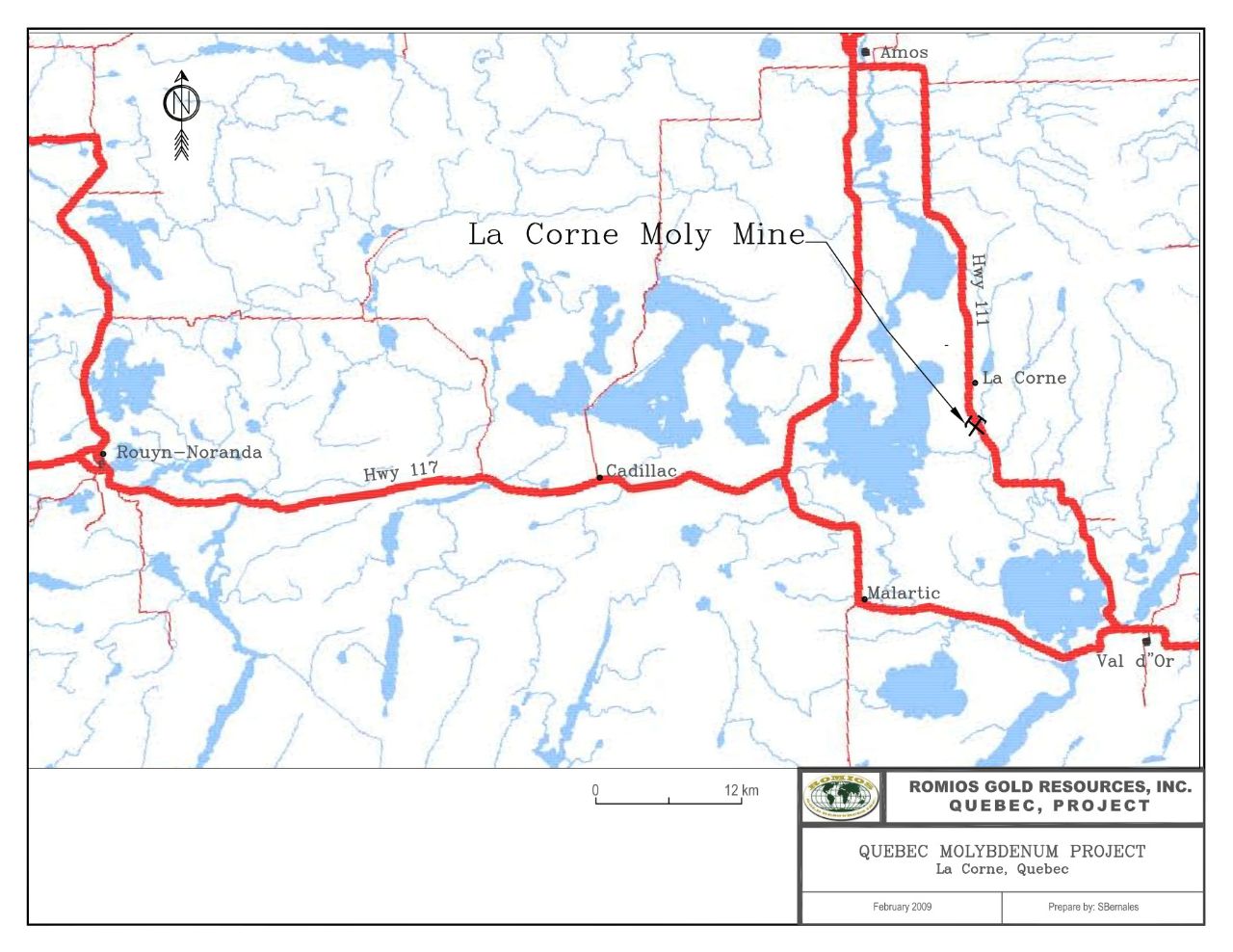 and approximately 30 kms from the town of Val d'Or, Quebec and is the site of the former producing La Corne molybdenum mine. The La Corne mine was operated intermittently by Molybdia Corporation Limited from 1951 to 1972 as an underground mine. Total production during this period was 3,838,844 tons of ore at a head grade of 0.33% MoS2 (6.6 lbs/ ton) and 0.040% bismuth (0.80 lbs/ton). The historical probable reserve calculated in 1974 was 1,440,000 tons grading 0.23 % MoS2 (4.6 lbs/ton) and 0.04 % bismuth (0.80 lbs/ton). This reserve is based on reports prepared by previous operators and should not be relied upon for any purpose. No qualified person (as defined by NI 43-101) has carried out sufficient work to classify the historical estimate as a current mineral resource or mineral reserve as defined in sections 1.2 and 1.3 of NI 43-101. Further work will be required to validate these resource estimates.
The mineralization occurs in a swarm of quartz-pegmatite veins hosted by a large sill or stock of biotite granite. The granite mass, so far as known, is a northeast trending body about 1,000 metres (3,280 feet) long and contained within the Preissac-Lacorne batholith. In the upper levels of the mine it is approximately 426 metres (1,397 feet) wide, narrowing to about 350 metres (1,148 feet) at the 228 metres level (750 feet). A biotite schist of sedimentary origin bounds the sill or stock to the north and south and also hosts sets of veins carrying molybdenum and bismuth.
Property consists of 28 claims covering 847.5 hectares, which are 100% owned by Romios, and five optioned Mining Concessions covering 234.5 hectares.
- Romios can earn a 100% interest in the Mining Concessions subject to a 3.0% NSR held by Vendors, of which half (1.5%) can be purchased for $500,000 (see Press Release dated February 05, 2009).
- Mining concessions are the site of the former producing La Corne mine, which produced 3,838,844 tons of ore grading 0.33% MoS2, and 0.04% bismuth.
- Romios completed a 5,738 metre diamond drill program in late 2008 to evaluate the open pit potential of the deposit (see Press Release February 12, 2009).
- Diamond drill hole RQ-08-08 intersected 145.60 metres (485.5 feet) grading 0.070% MoS2, 0.0055% bismuth, 0.398 g/t silver and 0.031% lithium.
- Diamond drill hole RQ-08-15 intersected 168.30 metres (552.16 feet) grading 0.079% MoS2, 0.0064% Bismuth, 0.120 g/t Silver and 0.012% Lithium (see Press Release February 12, 2009).
- Romios is evaluating historical and recent diamond drilling information to determine the extent of the mineralization and bulk tonnage potential of the deposit.